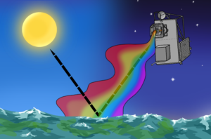
Do you know how we communicate with drones, vessels, and buoys far offshore? Are the appropriate systems in place to support the Ocean of the future? In this article I’ll breakdown how offshore satellite communication works and how it affects new ocean technologies like autonomous vessels and unmanned surface vehicles.
Communications and the Ocean of the Future
At present there exists myriad ocean technologies that operate offshore and send data back to shore. Offshore weather buoys collect valuable data that helps with weather forecasts and storm warnings. Long duration semi-autonomous vehicles like the Wave Glider and Saildrone monitor environmental conditions hundreds of miles from shore. In the not-so-distant future semi-autonomous cargo vessels will transmit machinery data and video feeds to shoreside operators in real-time to monitor navigation and engine performance.
Communicating with vessels and platforms at sea is not trivial. Generally there are no hardwire connections that one can plug into, which leaves wireless communication as the only real option. When data needs to be sent over relatively short distances or close to shore there are several options available such as WiFi or Cellular networks, but these are range limited. When vessels or platforms need to send signals over greater distances, for instance from the middle of the Pacific Ocean to Norway, there is really only one option: offshore satellite communications.
Message in a Wave
Satellite communications gets confusing real quick, but I’ll try to give you the 22,000-mile view. As an example, let’s say I want to read the seawater temperature from a thermocouple on a Liquid Robotics Wave Glider in the middle of the Pacific from the comfort of my computer here in Washington, DC. Starting at the Wave Glider, the thermocouple converts the temperature of the seawater into a digital signal which it sends to a data logger on board the vehicle. The stored data is then sent to an onboard satellite modem which transforms the data stream into a radio signal.

Just like ocean waves, radio waves travel through space in an oscillating pattern with peaks and troughs. The wavelength of a radio wave is directly related to its frequency, which is a measure of the number of times a wave passes a fixed point each second, expressed in Hertz (Hz). For offshore satellite communications signals are generally sent in the frequency band between 3 and 40 gigahertz (GHz). Data is encoded into these waves through modulation which typically involves varying the amplitude or frequency of the radio wave. The amount of data that a wave can carry is directly proportional to its frequency and its bandwidth, or the range of frequencies that the wave covers. The wider the bandwidth the more data that can be encoded into the signal. In more tangible terms: think of data as a stream of water in a hose – its flow rate is the frequency and the diameter of the hose the bandwidth. A wider hose can transmit more data, as can a higher flow rate.

The Networks Above
Returning to our example, the radio signal is transmitted from the Wave Glider via an antenna and travels at close to the speed of light to a satellite orbiting above earth. There are roughly 2,000 communication satellites above earth used for a variety of purposes [1], from television broadcasting to missile navigation. For our purposes, we are most interested in those that relay our data and connect our Wave Glider to the internet, of which there are perhaps 400-500 owned and operated by a couple dozen companies.
For the signal to reach the satellite, there must be a clear ‘line of sight’ between the transmitting device on the Wave Glider and the receiving satellite. This is where offshore satellite coverage becomes important. Coverage is the ability of a satellite to cover a certain geographic area. Most satellite companies (satcoms) limit their coverage areas to geographic regions with high demand for their services such as the African continent or Eurasia. The middle of the Ocean is not (yet) a customer hotspot, so coverage in these offshore areas can be limited.

LEO and GEO
No single satellite can provide coverage for the whole planet, so multiple satellites are linked together into constellations. Some constellations are far from Earth, others are relatively close. Satellites in geostationary orbit (GEO) are the furthest out at about 22,240 miles and orbit the Earth at the same speed at which the Earth rotates, thus appearing to stay in a fixed position relative to Earth [2]. At this distance, a single satellite can cover a wide swath of the planet and three or four can cover most of the globe.

Satellites in low earth orbits (LEO) are much closer to Earth than GEO satellites, generally between 100 and 1,000 miles above the surface. When viewed from the Earth’s surface LEO satellites are constantly moving, which can make it difficult for maintaining a direct line of sight with the transmitting device. Moreover, because LEO satellites are relatively close to the Earth, the coverage area of any one satellite is small. To side-step these limitations dozens are linked together to ensure that as one satellite orbits out of range, another is there to replace it. These large LEO constellations can provide global coverage, even at the high latitudes where GEO constellations struggle.
Depending on the orbit distance, our temperature signal sent by the Wave Glider can take anywhere from a couple milliseconds to over 100 milliseconds to reach the satellite. The satellite receives the radio signal, amplifies and changes the frequency, and relays it back down to earth where it is picked up by a receiver antenna on land. The radio signal is then run through a satellite modem once more to convert the radio signal back into a digital signal where it can be interpreted by a computer and read as a number on your screen. The time it takes for this signal to be sent and delivered is referred to as latency. Latency isn’t a huge concern when sending something like temperature data, but can be infuriating when trying to have a conversation, play a video game, or stream a video in real-time.
Shipping and Offshore Satellite Comms
This was a simple example of transmitting and receiving simple temperature data which could be accomplished with a very low bandwidth connection. Consider a more complicated scenario in the not-too-distant future: autonomous vessels. Over the coming decades cargo vessels will transition from manned (as they are today), to unmanned semi-autonomous and remotely operated, and then later to fully autonomous.
Vessels collect terabytes of data on everything from the engine plant to the outside environment every day. Crew on board the vessel can monitor these data locally, but as ships become more autonomous these data streams will need to be monitored remotely. To ensure the vessel is operating properly and that it’s kept out of harm’s way operators will need to monitor multiple live video streams, aggregated data from thousands of sensors, radar, and voice communications, just to name a few examples. If there is a situation aboard the ship, such as a fire or engine casualty, the operator will need real-time control of the vessel as seconds can make all the difference between floating and sinking. All of these data streams will require high bandwidth and low latency connections.

There are many different satcoms, each offering a unique combination of bandwidth and coverage for a given price point. Iridium, Intelsat, and Inmarsat, three satcoms with offerings geared to maritime customers, offer speeds from as low as 100 kilobits per second (kbps) to broadband services topping out at a rated 50 megabits per second (Mbps). 50 Mbps appears to be the present-day maximum for offshore satellite communication, which is just slightly better than my WiFi service here in Washington, DC. Keep in mind what a satellite is rated for versus what the customer actually observes are usually quite different.
Data Hungry Autonomous Vessels
Autonomous shipping will be one of the larger consumers of bandwidth in the Ocean of the future. Just how much bandwidth? It’s a difficult question to answer since there aren’t any vessels at the moment, but we can estimate. According to Bureau Veritas, a vessel classification society, autonomous vessels needing to stream data should have access to at least 4 Mbps for a single video stream, radar imagery, and telemetry [3]. This number is largely driven by the video feed, and I think it is an underestimate to think there will be one single video feed.
For example, Tesla has eight cameras on one of their vehicles, but a cargo vessel’s engine room is more complicated than a car. Due to the interconnectedness of ship systems when a piece of machinery on a ship fails it usually leads to cascading failure of other machinery. Personally I’d like to be able to view all those systems at once in real-time in order to troubleshoot and take corrective action.
Let’s be conservative and assume three video feeds (bridge and two engine room cameras) are required, this would increase bandwidth required to roughly 12 Mbps. These numbers agree with a report from Euroconsult that estimates offshore platforms require around 11 Mbps [4]. Keep in mind, this is just for one vessel. Just like streaming too many Netflix movies at once slows down your home WiFi, a fleet of remotely operated vessels all streaming simultaneously in the same area could bog down an offshore satellite connection. If 50 Mbps is the best on offer, this can only support around five remotely-operated vessels at a time on the same channel before pushing up against bandwidth limits. For companies that operate many vessels like Maersk, this probably won’t cut it.
Going Forward…
Satellite communication infrastructure may not be sufficient or cost effective for remotely operated vessels today, but that’s changing quickly. There are a number of companies that are racing to put up LEO constellations that provide global broadband internet with speeds measured in the hundreds of megabits per second. OneWeb and SpaceX are both trying to build out satellite constellations within the next couple years, definitely two groups to watch.
Offshore satellite communication is generally slower, more expensive, and more prone to bandwidth limitations than a hardwire connection. Merchant vessels will soon be moving to unmanned operation, and as they do so their need to transmit data will increase significantly. At the moment, it appears that our existing constellations of satellites won’t be able to support these shipping fleets of the future, but that is changing rapidly. New high-bandwidth satellite constellations will be able to provide truly high speed coverage anywhere on the globe, helping herald in a new era of shipping.
Note: Satellite communications is not simple – this article is meant as a primer to offshore satellite communications. There are a number of technologies that I didn’t include here for sake of brevity but which you may be interested in learning more about, including: frequency reuse, spot-beams vs wide-beams, VSAT vs MSS terminals, and any of the fancy stuff used by the military, such as WBS SATCOM.
[1] “How Many Man-Made Satellites Are Currently Orbiting Earth”. Ritter, Malcolm. March 2018 https://talkingpointsmemo.com/idealab/satellites-earth-orbit
[2] “Geosynchronous vs Geostationary Orbits”. GIS Geography. February 2018 https://gisgeography.com/geosynchronous-geostationary-orbits/
[3] “Guidelines for Autonomous Shipping”. Bureau Veritas. December 2017.
[4] “The State of Plat and Prospects for the Maritime Satcom Market”. Euroconsult. April 2017. https://static1.squarespace.com/static/57a8878837c58153c1897c2c/t/58ff111617bffcc1d32ddb39/1493111069924/4GeoffroyStern.pdf
[5] “Survey on Communication and Networks for Autonomous Marine Systems”. Zolich, Artur et al. https://brage.bibsys.no/xmlui/bitstream/handle/11250/2496201/PostPrint_Zolich_etal.pdf?sequence=2&isAllowed=y
[6] “Prospects for Maritime Satellite Communications” Euroconsult. 2018. http://euroconsult-ec.com/research/maritime-satcom-2018-brochure.pdf


